DUTCH navigator Joris van Spilbergen (born in Antwerp, now Belgium) in 1601 discovered one of the best natural harbours in the world, just 140km up the west coast from Cape Town and named it Saldanha Bay, after Portuguese navigator Antonio de Saldanha.
Travel with Dusty Miller
Saldanha’s claim to fame was discovering Table Bay in 1503, a good half-way stop for replenishing ships on the long voyage to the east.
But Saldanha Bay, an excellent natural harbour lost out to Table Bay, with no natural harbour or protection from the vicious storms that blast the southern tip of Africa, because the former had no fresh water available and at Table Bay there was plenty.
The Portuguese were the first colonial power to use the Cape as a half-way stop to their possessions in the Orient but, unfortunately, misunderstandings, cultural differences and exploitation of the indigenous people left 75 Europeans dead on the beach. As a result, Lisbon decided to make Mozambique farther up the east coast, their half-way stop instead.
Other European powers began to use Table Bay as a half-way stopover. None, at first, tried to set up any physical structure, be it a house, fort or jetty, to help them in trading with indigenous people.
That was left to Dutch merchant Jan van Riebeeck who, in 1652 landed at the Cape to set up a permanent replenishment station under the orders of the Dutch East India Company (VOC: Vereenigde Ooostindische Compagnie). Water, fresh vegetables from the newly planted Company Gardens (still a tourist spot) and fresh meat were supplied to passing ships that put into Cape Town, soon nicknamed “The Tavern of the Seas”.
Van Riebeeck built the first permanent structure: Fort de Goede Hoop. It wasn’t as permanent as he hoped, as it was made with mud and timber. Later the Castle of Good Hope (it can still be visited today) was erected in stone.
- Chamisa under fire over US$120K donation
- Mavhunga puts DeMbare into Chibuku quarterfinals
- Pension funds bet on Cabora Bassa oilfields
- Councils defy govt fire tender directive
Keep Reading
In 1656, van Riebeeck also made a jetty of a wooden deck, supported by sunken boxes filled with rock. The jetty, the first structure to link land and sea at the Cape was still in use in 1679, during the time of Simon van der Stel (last Commander, first Governor of the Cape.)
Not all craft stopping over at the Cape used the jetty to load or offload cargo. They would anchor offshore at a safe distance; small lighters or cargo boats were sent out to shift freight. Highly skilled “Cape Coloured” boatmen were used for this task as they knew the bay and its moods well.
These men could earn a fortune when the weather turned really bad, as owners of ships under threat in the bay would pay well for an extra anchor to be rowed out to them. Good money was made but many who took this risk paid with their lives.
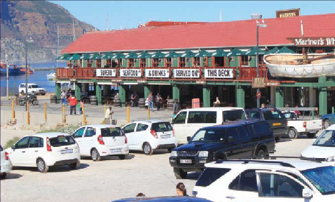
Cape Town grew at a rapid rate, the town spreading along the beach and up into the mountain. Along the beach, which was known as Roggebaai (“Bay of Skate”) the fishing industry, sailors and townsfolk shared the same space. That was an important link to the sea which Cape Town lost when, in 1935, the 140 hectare Foreshore was created through backfill when developing Duncan Dock.
Bad weather had been a problem for shipping from the start; it was with good reason that Bartholomew Dias, a nobleman of the Royal Portuguese household, in 1488 called it the “Cape of Storms”. With many vessels shipwrecked or sunk as a result of notorious storms, there are many stories of tragedy and brave rescues, such as that of Wolraad Woltemade who drowned with his horse in 1773, after saving 14 people from the ship Jonge Thomas, which was in trouble.
Governor Hendrik Swellengrebel took the first step towards protecting ships against harsh winter weather and the dreaded sou’ easter wind which ripped ships from their anchors and drove them onto the rocks and beaches of Table Bay.
He proposed a breakwater at Mouille Point. VOC was approached for finance, but to no avail.
He then came up with a plan that every farmer dropping goods off in Cape Town must take a load of stones to The Point to be dropped into the waves to create a breakwater. About 100 metres were built before the project was aborted due to a lack of enthusiasm.
The Dutch called this a “moilje”; the French allies of the Dutch erected an artillery battery at this site in 1781 and called it Mouille Point Battery, the French word “mouiller” meaning to drop anchor.
Under Dutch rule, no more attempts were made to defend the Cape against winter weather, but they added two more batteries on the rocky site of the present day Waterfront as defence, not against local tribesmen, but from unfriendly European powers.
First built was the formidable fortification of Chavonnes Battery, begun in 1712. This has been restored and can be visited in the Nedbank Clocktower building. The second battery was the even bigger Amsterdam Battery built in 1785.
It was near the present City Lodge but remains buried under centuries of rubble and city growth. There is talk of unearthing it and restoring it as far as possible.
These forts were two of 28 built around Table Bay during both Dutch and British rules, giving rise to Cape Town being given the name the “Gibraltar of the South.” More about Cape Town’s history and current attractions in next week’s NewsDay. [email protected]; [email protected]